Flash Flood, Tornado warning and Haboob Hello,
the last two days offered again very exciting and diverse weather. Rarely can you name within less than 48 hours 31 ° C and dusty roads and 13 ° C in the downpour, bright sun with gusty south wind and severe storms, including severe dust storm to do so close to each other, as was the case with us.


On Memorial Day (Monday) on which they do in the U.S. those killed in the last war and the veterans began the day for us in McCook, Nebraska. A Slight Risk issued by the Storm Prediction Center and we presented a strong storm, possibly one or two super-cells. The wind shear was somewhat weak in the chest, so it should probably be more storms, especially the cool, strong downdrafts were determined and less of rotating thermals, tornadoes and the like.
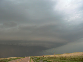
Well we went yesterday for a sociable chat with the tenants of one of Days Inn Motel in McCook (for delicious sandwiches were also the same time exchanged contact details) about noon on a lonely highway north through the hilly, fairly barren landscape. With strong southerly wind blew over again flat clouds approaching from the south, there were also first with a few cirrus clouds little to see. Julian and I took the time to get to brown a bit and to look out for any animals. Soon, however, was located southwest of our observation site, a small cluster of somewhat stronger Cells.
These cells, more specifically, a thick version, moved very slowly and it had formed on the flanks of this storm ever new storm. Finally gave the National Weather Service out for the whole region, a flash flood warning, since it was from heavy rain and flooding. We tried the meantime, come north to North Platte and drove even after the Interstate 80 West. As it turns out that from the west meet is not as much, and should the storm here in the near time and again formed, we decided for a ride back toward McCook. This option led us in the middle of pure Flash-flood history, After a while the waters came down from heaven so close that we could not see 20 meters wide. Left and right gathered in the meadows and fields of water, the sky was dark gray to brown and always flickered somewhere above us flashes. Even some hail was present us we needed a good 30 minutes to get out of the cloudburst once again come out.
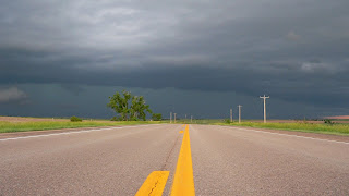
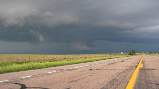
some point we had it then made it and we watched from the South Rim ago on this (with cold air blowing in our direction) system, as we heard about the weather radio that within a few hours not far from our Highway, 175 liters of good rain has poured onto the square. This affects unfortunately were not only rural areas but also a few villages in the area.
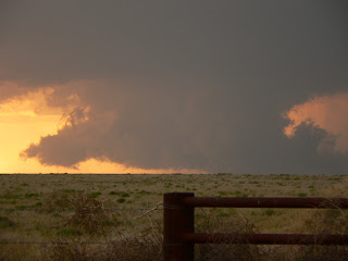
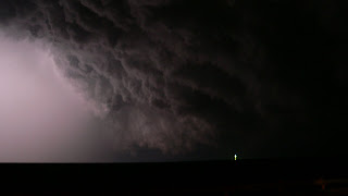
developed the evening, on the southern and southwestern edge (for the Mets: thanks LLJ) strong new cells and a tornado was even bewarnt. We have seen up close. Effective display worked its way out for about 15-20 minutes a circulation, but the air was in the vicinity of the storm from the previous rain rather cool and stable, there is nothing out of the tornado warning has become. It was great to watch, however, as the cell is very short time increased and the flash rate was higher. Again and again hammered into the ground and blinding flashes.
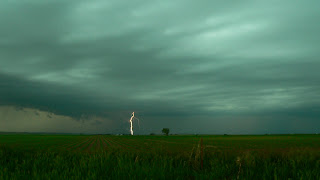
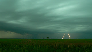
Later that evening we were offered more cells a fireworks display, as I have rarely seen. It reminded several strobe lights, which flickered like crazy ... Unfortunately there are no photos, but later still videos.
On Tuesday we made our good time in a new "target area", this time it looked like the morning after data from storms in southwestern Kansas and southeastern Colorado. So we went to a small breakfast (which was attended by a Stormchaser Tour of Roger Hill, with over 20 people) to the south in the direction of Garden City, Kansas. Once there we found at least a strong southerly wind and shallow cumulus clouds, the air was very dry (dew point: 14 ° C) to the west and there was not even more, but even fewer clouds. Something was wrong and that new data check confirmed our feeling that has Slight Risk is sometimes just shifts it some 200 miles northwest. After supercell saw it first in our region now from no more and so we drove back north, angry, but the weather can not always look to the cards. Colorado, meanwhile, already went through it around with several severe storms and tornado warnings a few. All of these storms should continue in the following hours walk to the east and southeast Kansas gene.
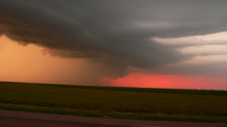
On the way to the northwest via Interstate 70, the radio beeped again and Weather There were several warnings of gale force winds and hail from a huge line. The same edge we reached the small town west of Colby, and it was all over western and north-west jet black. This roller was moving at 50 km / h to the east and the wind blew in the gust front so severe that vast amounts of dust and earth torn up and shipped across the landscape were. This whole storm front slowly changed to the dust storm and the sky was eerie brown.
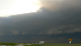
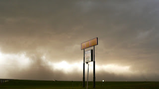
In Brewster we were on a small gas station and it was promptly run over stormy, cold and dust was everywhere, in enormous clouds he flew over the landscape, the wind picked up and pulled at signs and bushes in nearby power lines, it howled.
thundered After an initial vulnerable phase, then a few gusts over our site and other materials were pulled up in dust, soil and small stones. On video you can see the dynamics of the whole good, wait for the cutting of the clips but it still needs.
After a while we headed back on the road to the east (also out of concern wg to our equipment. Dust) and tried to get out of the system. Much later succeeded to us also and we ended up again in Hays, Kansas. The line was now at 23h still west of the city, while We quickly with gusty south wind and humid 20 ° C bought something next to the motel a few beers. In the view of the radar was clear, one of the most intense part of the over 200 km long line zuhielt exactly Hays. At this point I must mention that we have at our tornado last Tuesday in Hays have already experienced a severe downburst (case gusts in thunderstorms) with 120-140 km / hr. If there are similar this time? The warnings sounded so gusts exceeding 100 km / h were possible. After a few minutes it was already going on then, only with dust, then downpour. The water was lashed by surges in the city, the peak gusts were around here at 103 km / h.
News
blows it out there are still violent, but most of it is due. Even if it was not enough for a tornado (there were five reports today, but only very short-lived events in Colorado), so it was a pretty impressive Chasing.
Ciao, Lars
+ Julian